
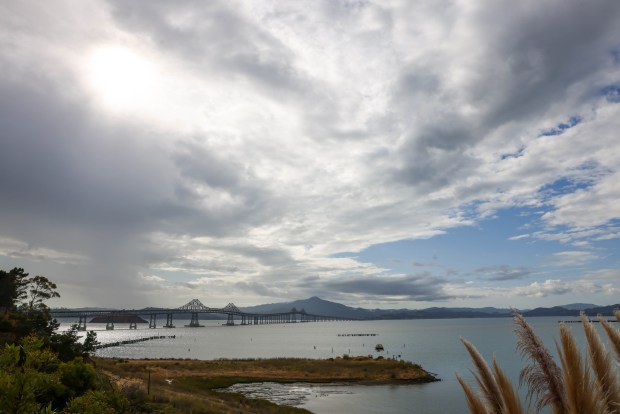
A cold front zipped through Northern California on Saturday, bringing showers and a chance of lightning, but a big shift is in store later this week: Tank tops and sandals are in the forecast, as temperatures could hit higher than 90 degrees in the South and East Bay.
The heat wave could tie or possibly break a record of 91 degrees this Thursday in San Jose, which dates back to 1930. The thermometer on Thursday could hit 87 in Oakland, 81 in San Francisco and 92 in Concord.
“Today was 10 degrees below average,” said Dylan Flynn, a meteorologist with the National Weather Service in the Bay Area of Saturday. “By around Wednesday to Thursday, we will be 10 degrees above average. For early October, that will be a notable heat wave.”

The schizophrenic weather comes as California on Sunday enters what meteorologists consider a new “rain year,” after a series of major storms last winter ended the Golden State’s latest drought.
Saturday’s showers added to the total with a dreary day that spread wet weather down the state.
“The front was moving pretty fast and is already well into Southern California,” Flynn said Saturday afternoon. “But it was associated with an upper-level low system, which is causing wraparound showers in Sonoma and Napa moving north to south. Some of those structures are looking quite robust, and we can’t rule out more showers or even a lightning strike or two.”
The showers were expected to end in the Bay Area by Saturday evening. Some areas saw moderate wind as they passed through, but the bulk of the windiness occurred that morning.
By Saturday afternoon, rain gauges measured traces to a few hundredths of an inch of precipitation in most of the Bay Area, though some mountainous regions received a quarter inch.
Sunday brings in the new “water year” – a way that meteorologists divide up precipitation measurements for specific regions over time. It turns out the Bay was pretty wet during 2022-2023, experiencing one of the biggest water years in a long time.
“I think we were about 140 percent above average for San Francisco,” Flynn says.
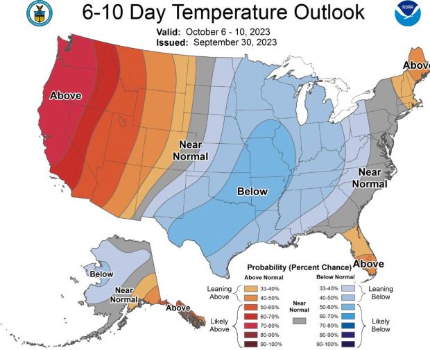
But a big change is on the way as an unusually strong warming pattern shapes up next week. It’s possible that records could be challenged throughout the Bay.
“Historically, the first week of October is one of the warmest weeks of the year for us. It’s when we get our offshore wind pattern,” says Ryan Walbrun, a meteorologist for the National Weather Service in the Bay Area.
“The models are saying it could be 90 to 91 degrees on Wednesday, which would put us within a degree of the records there,” says Walbrun. “The record high for San Jose on Oct. 5 is 91, and that goes back to 1930. So yeah, it looks like we’ll be within record territory.”
Source: www.mercurynews.com